
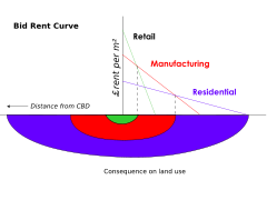
Based on human ecology theory done by Burgess and applied on Chicago, it was the first to give the explanation of distribution of social groups within urban areas. This concentric ring model depicts urban land usage in concentric rings: the Central Business District (or CBD) was in the middle of the model, and the city expanded in rings with different land uses. It is effectively an urban version of Von Thünen's regional land use model developed a century earlier.[2] It builds on Homer Hoyt's sector model and the multiple nuclei model.
The zones identified are:
The zones identified are:
- The center was the central business district,
- The transition zone of mixed residential and commercial uses or the zone of transition
- Working class residential homes (inner suburbs), in later decades called inner city or zone of independent working men's home
- Better quality middle-class homes (Outer Suburbs) or zone of better housing
- Commuters zone
